|
The United Nations General Assembly has declared 2021–2030 the Decade on Ecosystem Restoration, during which the recovery of degraded nature should be massively upscaled to effectively fight the climate and biodiversity crises. Furthermore, the Parties of the Conference on Biological Diversity confront the challenge of setting ambitious targets to not only protect species and ecosystems, but also to revert degradation trends and restore functional nature. The scientific community plays a key role in building the knowledge base necessary to support the global restoration agenda, with scientific research in spatial ecology, macroecology, biogeography and at their intersections with society and policy particularly relevant. This Ecography special issue addresses this need with a set of empirical and theoretical articles that also point to next directions for the field of restoration science. I co-edited this special issue with Néstor Fernández, Henrique M Pereira and Jens-Christian Svenning. I led the writing of the editorial, and of one of the contributed papers. Also see the video abstract that describes what Restoration is and what research is currently going on. And finally, listen to Ecography editor Jens-Christian Svenning talk about Restoration Ecology and why it is important for the future of biodiversity. Podcast here. Gold Open Access issue: https://onlinelibrary.wiley.com/toc/16000587/2022/2022/4 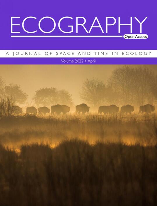
2 Comments
Since February 2022, and in parallel to my current position, I joined the organisation Rewilding France as active member and scientific advisor. I am thrilled to work with a very dynamic team towards a shared vision of increased ecosystem restoration and coexistence between human activities and wild nature.  Check the website for more information: https://rewildingfrance.org/ And follow us on social networks! A news article about my recent work was published in the magazine Current Conservation: Where big mammals belong—the unfair burden to restore, by Adam Curt Custock 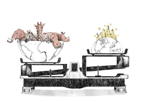 Artwork by Indrani Ghosh This blog post is a re-post from the BIOCHANGE website, Aarhus University. Original article HERE. It is 6h30 in the morning when two wolves emerge from their sleep in the Abruzzo, Lazio e Molise National Park in the Central Apennines region, Italy. Eight of us are watching in perfect silence, as we sit still on a hill some 200m away. We detected their presence using a night vision lens and are now following their movements with our binoculars. As they move towards us, we anticipate the moment they might pass right beside our hiding place, but they take a left turn instead, and disappear out of sight. The observation lasted only ten minutes, but is imprinted in our mind as one of these moments suspended in time, where wild nature can act unbothered by our human presence. It is November 2021, and we – five postdocs and one assistant professor from BIOCHANGE– are visiting the Central Apennines rewilding site, one of the nine European sites supervised by the organization Rewilding Europe. We are here to learn how rewilding – an ecosystem restoration strategy focused on restoring natural processes and keystone species – happens in practice. 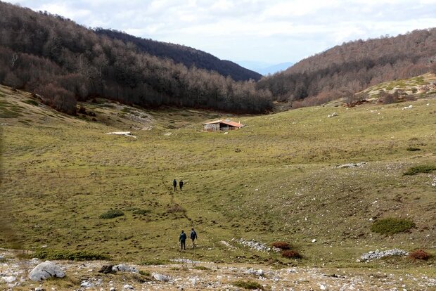 Our team arrives at the Terraegna mountain refuge, not far from where we saw two wolves the next morning. The hut was recently refurbished and is managed by Wildlife Adventures, a partner of Rewilding Apennines offering hiking, trekking and wildlife watching in Central Apennines. Photo by Sophie Monsarrat When the theoretical basis for rewilding was first established in the late 1990’s, Michael Soulé and Reed Noss identified the three C’s – Core, Corridor, Carnivore – as key components for successful ecosystem restoration. This made sense in a North American context, where large National Parks excluding most human activities were historically set aside for nature, at the cost of local communities’ livelihoods. In contemporary Europe where this divide is no longer possible – nor desirable – another C emerges as a cornerstone of rewilding: Coexistence. As we are about to learn during this week, coexistence is a hard-earned prize in areas where large carnivores roam cultural landscapes. Wolves and endemic Marsican bears are found in relatively high densities in the Central Apennines, one of the few places in Europe where they did not disappear historically. Today, the recent history of rural depopulation and land abandonment in the region appears as an opportunity to support the recovery of these large animals and the restoration of natural processes. But focusing on restoring keystone species while ignoring the tensions with human populations still inhabiting the land would be a mistake. Local communities often bear the costs of living with predators without reaping the economic and social benefits that these animals can bring. For wildlife to flourish in these areas, local acceptance must be built through supporting local livelihoods and establishing relationships of trust between practitioners and stakeholders, highlighting the mutual benefits that can arise from coexistence. Focusing their activities on corridor areas connecting existing protected areas, the Rewilding Apennines team does just that. They focus on monitoring wildlife and improving the quality of their habitat, preventing and mitigating human-wildlife conflicts and building links within the local community to promote rewilding as an alternative economic model. Their vision is one of wildness where human activities respectful of the environment exist alongside wild animals and natural processes, in a shared space. What we learned from our visit here is that this vision requires compromises – not every activity will be beneficial for biodiversity, and tension will continue to arise from coexistence with large animals. However, it is a useful trajectory to guide decision-making; one that encourages more sustainable practices than current models of development and inspires more pragmatic management strategies than classic visions of conservation excluding humans from nature. The future will tell if the model promoted by Rewilding Apennines can succeed in achieving the right balance between human activities and ecosystem recovery in this area. Still, in this time of environmental crises and societal turmoil, every step in the right direction matters. On our last night, one of our guides admitted that his hope is that increased coexistence will evoke an innate connection with nature and encourage people to respect and value their wild backyard. There is diversity in humans’ attitude towards wildlife, and a long way to go before large predators are widely accepted as part of European cultural landscapes. Yet, the raw emotion we felt while observing these two wolves on a foggy morning was certainly evocative of this hope.  The village of Ortona dei Marsi, where Rewilding Apennines rents a house to host their volunteer program. It is located on the edge of “Corridor 1”, identified as an important ecological corridor for the Marsican brown bear, connecting the Sirente Velino Regional Park and the Abruzzo, Lazio e Molise National Park. We found marks of bears and wolves just outside the village, testifying of the proximity of these animals with human settlements. Photo by Sophie Monsarrat Original text published on: https://bit.ly/EcogRSI
The world is facing an environmental emergency, manifested through the joint biodiversity and climate crises. To overcome this massive challenge and promote a more sustainable development, the United Nations General Assembly has proclaimed 2021-2030 as the UN Decade on Ecosystem Restoration. Ecology is central to the success of the global restoration efforts. As the journal for space and time in ecology – key dimensions for effectively addressing global environmental change – Nordic Society Oikos journal Ecography will publish a special issue to improve the scientific basis for the highly needed global restoration efforts. Linking restoration to Ecography’s core focus, we have invited (and gotten commitments for) manuscripts that will provide novel insights into how fundamental empirical and theoretical work in spatiotemporal ecology and macroecology can inform ecosystem restoration. However, we want to cover ecosystem restoration broadly, from rewilding to restoration in urban and farmland context to spatial prioritization to socio-ecological and socio-economic perspectives, and for that reason here offer an open call for papers on ecosystem restoration. Submitted articles have to broadly fit Ecography’s aims and scope. The special issue will be edited by Ecography’s Deputy Editor-in-Chief Jens-Christian Svenning, subject editor Henrique Pereira, and early-career guest editors, Sophie Monsarrat and Nestor Fernandez. Dead-line for submission of papers: 1 April 2021. Submit your manuscript here: https://mc.manuscriptcentral.com/ecogra Questions? Please email at [email protected] Looking More Deeply Into the Past to Gauge the Planet’s FutureMay 18, 2020 by James Dinneen In 1995, biologist Daniel Pauly made a shrewd observation: Scientists in his field had forgotten about the past. Pauly, who studied commercial fishing at the University of British Columbia, observed that fisheries scientists tended to measure change in the abundance and species composition of the fish stocks they studied relative to what they were like at the beginning of their careers. As fish stocks declined, each new generation of scientists generally accepted the new normal as the natural state of things. “The result obviously is a gradual shift of the baseline,” Pauly wrote, “a gradual accommodation of the creeping disappearance of resource species.” He called the phenomenon “shifting baseline syndrome.” The idea provoked widespread discussion among fisheries scientists and the broader conservation community, for whom it had disturbing implications. If the baselines were shifting, then basic statistics on population decline and targets for recovery were likely to be underestimates. Things might be worse than they looked, and with severe environmental degradation and declines in biodiversity underway, conservationists knew things already looked bad. Research on shifting baseline syndrome since Pauly’s observation suggests it could be pervasive for scientists and regular citizens alike, according to a 2018 review published in Frontiers in Ecology and the Environment. Despite historical declines in biodiversity and ecosystem health, people tended to assume that the natural environment of their childhood was how things had always been. The reviewers reported this “generational amnesia” increased tolerance for environmental degradation and pollution, while changing people’s feelings about what in the natural world was worth protecting. The reviewers blamed the shift, in part, on a lack of historical ecological data. Pauly suggested something similar back in 1995. The antidote to shifting baseline syndrome, he argued, is historical knowledge, especially anecdotal information like the stories of old fishers. “The big changes happened way back,” he wrote, “but all that we have to recall them are anecdotes.” Scientists who study ecosystems of the past, however, know there’s a lot more data than that. In the decades since Pauly’s complaint, researchers have regularly pointed out that long-term data, from the fossil record to the journals of early explorers, can help shift back the baselines. Concerns about the limitations of old data have been a roadblock to its widespread use, but scientists are now pushing for new conservation efforts to apply the data as they search for insights on conserving species in the shifting world of the human-dominated epoch, the Anthropocene. The realities of shifting baselines are “far bigger than I ever thought,” said Pauly, now the principal investigator with Sea Around Us, a fisheries science and data initiative at the University of British Columbia. “It is in fact terrifying.” In much of the world, ecological monitoring data was not regularly collected until late in the 20th century. Still, the long-term ecological past is not entirely obscure. Ecologists who reconstruct and study past ecosystems have diverse sources of data and methods to go way back in time, before the global industrial revolution, before European expansion, before some of the big changes. These data have included fossils, pollen, cave paintings, bone fragments, place names, records from industry and government, old letters and journals, indigenous knowledge, and genetic information; all the resources of paleontologists, archaeologists, and historians brought to bear on ecosystems. “It requires imagination, which scientists sometimes don’t have,” Pauly said. “Because lots of us are really accountants, or stamp collectors, and not as imaginative as we should be.” In Hawaii, marine ecologists have used restaurant menus from the early 20th century onwards to understand fish abundance in coral reefs. In Egypt, one biogeographer turned to Pharaonic monuments and hieroglyphs to determine the range of the hippopotamus, which is now extinct in the country. Researchers have used centuries of records gathered by local officials in China to determine where several species of small apes lived long ago. In addition to giving a more complete picture of past ecosystems, conservationists have proposed other uses for this data. For instance, models of how ancient ecosystems responded to shifts in the climate could improve predictions of how climate change will affect current ecosystems. Yet despite what many researchers see as the potential of historical data, it is still usually left out of the assessments that drive conservation policy and funding. According to one 2010 study in the journal Conservation Letters, only 15 percent of assessments of long-term population decline used data older than 100 years. For many species, such as the hawksbill turtle, populations of which were decimated as early as A.D. 1800, even 100 years is not far enough back to avoid a shifted baseline. “I think we’re generally very focused on the present — What’s happening now? What are the problems we need to address now?” said Molly Grace, a conservation biologist at Oxford University. “So there’s this whole other field of paleoecology and historical ecology that has tons of data that hasn’t really been tapped into in conservation.” In 2019, Samuel Turvey, a conservation biologist at the Zoological Society of London, and Erin Saupe, a paleobiologist at Oxford, organized a meeting at the Royal Society of London to gather scientists from disciplines that study past ecosystems to discuss how their work might help current conservation efforts. “The potential for this source of data to contribute to conservation — both in terms of conservation science and practical conservation planning — has really taken off in recent years,” Turvey told Undark in an email. “We are also still gaining a more coherent understanding of what the past can tell us, versus what it can’t. What are its limitations as well as its strengths?” So far, Turvey and Saupe concluded after the meeting, the potential hasn’t been realized: “Although the importance and value of integrating past and present is now widely discussed as a novel paradigm in conservation, the reality lags far behind the theory.” One reason long-term data is not regularly included in conservation assessments is because conservation scientists are taught to think of their field as a “crisis discipline,” Grace said. Occupied with preventing imminent extinctions, conservation scientists don’t always know enough about older information to use it. When conservation scientists do know about the long-term data, it is often perceived to be too unreliable or too incomplete to be applied to the pressing, practical concerns of protecting species today. “Ever since Darwin people have banged on about how awful, incomplete, and biased the fossil record is,” said Turvey at the Royal Society meeting. “But in reality all sources of scientific data have got incompleteness and bias.” Historical data can be especially difficult to deal with. “These are very challenging records,” said Sophie Monsarrat, an historical ecologist at the Biochange center at Aarhus University in Denmark. When the records exist, they are often hidden away in old books in obscure archives. Researchers must find those records and scour them for references to the natural world: What species? Where? When? How reliable are the records? The data pulled from the records then must go through a series of statistical gymnastics to make up for biases and incompleteness. “If you want to know the past you cannot sample it the same way,” explained Pauly. “You have to sample people who have sampled.” In other words, it’s a mess. It might also require visiting distant libraries and working in multiple languages. And it’s slower than collecting new data, which researchers have cited as a serious concern for under the publish-or-perish system in academia. Monsarrat is familiar with the joys and frustrations of historical ecological data. Now working on wilderness restoration projects — also called rewilding — she has squinted at 19th-century whaling records from the New Bedford Museum in Massachusetts and combed through archaic references to the large mammals of South Africa. Her career straddles the divide between historical ecology and conservation. In South Africa in 2017 and 2018, while a postdoctoral researcher at Nelson Mandela University, she worked with ecological data collated from letters, journals, diaries, and books from the past 500 years of colonial history, starting with Vasco da Gama’s observation of elephants in Mossel Bay in 1497. That 500-year dataset had been painstakingly collated by her supervisors André Boshoff and Graham Kerley, who were themselves building on decades of work by an eccentric ornithologist named Cuthbert John Skead. “I was lucky to arrive in South Africa when the data collection was pretty much done,” Monsarrat said. Still, she acquainted herself with the records to gain a sense of historical context. She needed to know, for example, that when British colonists wrote “tiger” they really meant “leopard.” Places change. Sensibilities change. Who was writing and why were they writing? “You start by looking for very specific things — records, locations, species names,” said Monsarrat. “And you start getting lost in the description of the daily life. It’s very fascinating. They were these European travelers just discovering a new world and describing the world in very colonialist ways, very often.” To account for biases in the data, Monsarrat spent a lot of time reading through records, trying to understand how people — primarily European colonists — perceived the wildlife they encountered. “I would say it was very utilitarian,” she said. “You often have these descriptions of this animal and they describe how beautiful it is and then they shoot it. They shoot everything. It’s very striking how much death and how much animal shooting happens. I remember this one passage describing a leopard: ‘Female, yellow, very beautiful — I shot her. But then she had cubs, so I shot them.’” Monsarrat’s work culminated in a 2019 paper quantifying how leaving out the long-term data led to shifted baselines for the historical distribution of 12 species of large mammals in South Africa. And while it was rooted in historical ecology, it was oriented towards conservation. It was what Pauly had called for in 1995: Anecdotes from the past shifting back the baseline. Without considering the historical data, the study showed, conservation planners risked underestimating the long-term range of species they want to conserve. This could also lead to underestimates of a species’ preferred habitat, throwing off projections of how that species may respond to climate change and other pressures. “Today’s range is a fraction of what it was in the past for most species, especially for large mammals,” said Monsarrat. “You can’t project into future climate change if you don’t have to right data to start with.” While studies like Monsarrat’s have long been informally incorporated into conservation management, there’s currently no consistent way to bridge the gap. That may change with the Green Status, a new conservation framework being developed by scientists from the International Union for the Conservation of Nature (IUCN). Monsarrat said this will “try to take it to another level.” The Green Status, set to launch at the IUCN World Conservation Congress (postponed from June 2020 to January 2021 due to Covid-19), will be a companion to the IUCN Red List of Threatened Species, which is the most widely used source for the extinction risk assessments that drive global conservation policy and funding. While the Red List focuses on preventing extinction, the Green Status will focus on recovery. In order to define recovery in terms of the historical abundance and distribution of species, the Green Status will require historical baselines — and long-term data. The new policy is part of a broader shift in conservation biology, said Grace, who is also the IUCN task force coordinator for the Green Status project. “We’ve started to think more long term.” But even within the Green Status, researchers haven’t always agreed on how to set historical baselines. Initially, the task force proposed a one-size-fits-all baseline for all species either at A.D. 1500 or A.D. 1750 — benchmarks for the beginning of European expansion and the global industrial revolution, respectively. A more recent date would mean more data would be available, but there would be a greater risk of shifted baselines due to human impact, explained H. Resit Akcakaya, a professor of ecology and evolution at Stony Brook University and a member of the Green Status task force. “There’s a tradeoff,” he said. Some researchers pushed back on the idea of a universal baseline entirely, pointing out that it would not be ecologically or historically relevant for many regions, since human impacts vary so much around the world. Now, where possible, Green Status assessments will tailor baselines to human impacts on particular species in particular regions. “That’s a good principle, but practicality must be considered,” said Akcakaya. Namely, he added, are there data? Grace and Akcakaya are quick to clarify that the historical baselines used in the Green Status will not represent an ecosystem’s so-called pristine state, or even necessarily a desirable one. (“You can’t have lions in Greece and Turkey. It’s just not practical,” said Akcakaya, referring to the fact that the big cats lived in Greece as recently as 100 A.D. and Turkey as recently as the 19th century) But knowing the full extent of the changes can support more ambitious conservation goals, they said. It’s about a change in perspective — a shift of the baseline. “You cannot present reestablishment without proper baselines,” said Pauly. “I think it’s good that we will have a spot where we will find all the reestablishment stories and where we can find that, in principle, it all works.” However, he is concerned that success stories might distract from the dire situation for many other species. According to the United Nations, a million plant and animal species are threatened with extinction. Grace views the Green Status differently: “We see this as a way of documenting what’s been lost,” she said. “Our thinking is that it’s good to know the scope of human impact on a species and to not let people off the hook so easily.” Not letting people off the hook, for tens of thousands of species, will require a lot of very old data, and a fresh descent into the archives where they keep the bones and dustiest books. It will be a victory for the researchers who have long wanted to see the long-term data suffuse the world of conservation. “It’s waiting to be found,” said Grace. This article was originally published on Undark. Read the original article.  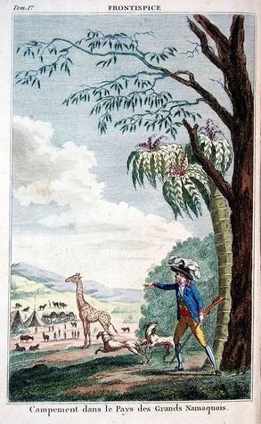
Frontpage of Voyage de F. Le Vaillant dans l'intérieur de l'Afrique par le cap de Bonne Espérance nouvelle édition, Desray, An VI. Jeffdelonge / Public domain
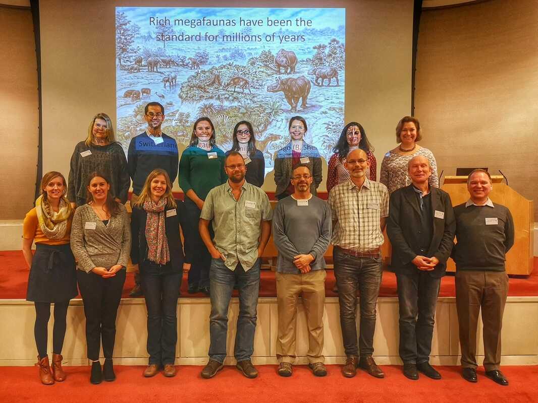
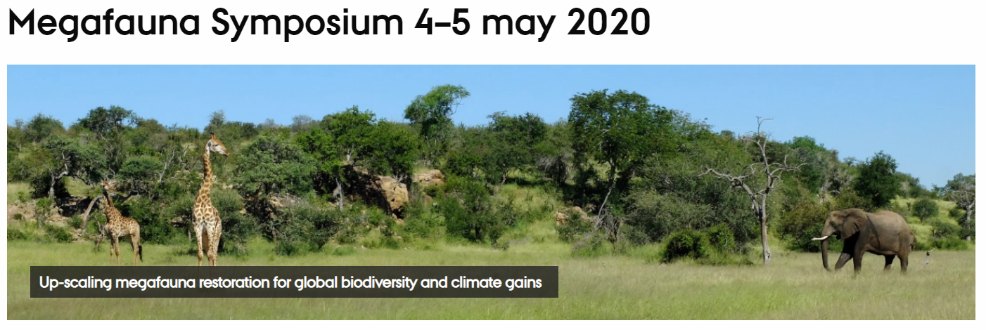 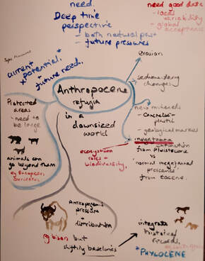 A sketch based on my presentation on Anthropocene refugia, by researcher and illustrator Catherine Williams. A sketch based on my presentation on Anthropocene refugia, by researcher and illustrator Catherine Williams. On the 4th and 5th of May 2020, the BIOCHANGE group at Aarhus University hosted a symposium on megafauna restoration. Initially meant to take place at the beautiful Moesgaard Museum in Aarhus, the meeting had to be reorganized as an online event due to the COVID-19 pandemic. If it meant missing out on the fun that is usually associated with social activities in conferences, we managed to reproduce most of the benefits of a face-to-face meeting and make it a very enjoyable moment!
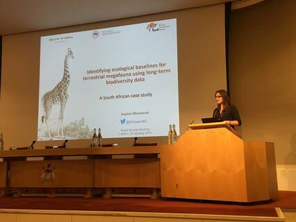
The symposium gathered 9 guests and 7 local speakers from the fields of megafauna restoration, macro-ecology, climate science and human-wildlife coexistence to address key questions regarding upscaling of megafauna restoration for global biodiversity and climate gains, in front of an audience of ca. 60 people from all over the world. This was the occasion to present my recent paper on Anthropocene refugia, for which you can find a PDF of my slides HERE. Importantly, we invited the talented Catherine Williams, veterinarian, postdoc and illustrator to attend the symposium. She illustrated each presentations with inspired sketches that she drew at an impressive speed. This was a huge plus to make the meeting more lively and interactive. I love her take on my research! Check her website here: https://catherinewilliams.weebly.com/ Overall, in addition to very rich scientific discussions, this experience taught us that online meetings have a great potential to bring together the scientific community while reducing the environmental costs of travelling. In fact, removing the barrier of travel allowed from a much more diverse audience to participate in the discussion than if the symposium had been held in Aarhus, as originally planned. A win-win for everyone! As many other scientific groups are experiencing the same situation throughout the world a the moment, one can hope that this solution will be increasingly considered in the future, even after we are allowed back in the air. For additional reading on virtual conferencing for ecology and conservation, you might want to have a look at this paper: https://conbio.onlinelibrary.wiley.com/doi/full/10.1111/cobi.12837 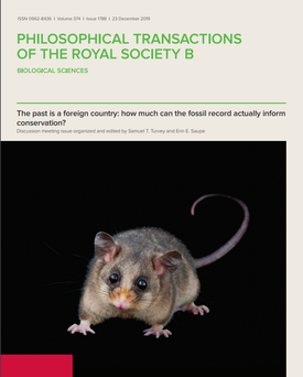 A new special issue entitled ‘The past is a foreign country: how much can the fossil record actually inform conservation?’ is published today in Philosophical Transactions of the Royal Society B. Edited by Erin E. Saupe and Samuel T. Turvey, this special issue combines the perspectives of conservation biologists, Quaternary palaeontologists and deep-time palaeontologists to identify ways in which deep-time and near-time data can be used to inform conservation, discuss the barriers and limitations in the use of past data to inform conservation and practical ways in which past data can be, and are already being, fed into conservation policy and management. Invited to participate in that issue along with other collaborators, we contributed with three papers, arising from very different projects: - Anthropocene refugia: integrating history and predictive modelling to assess the space available for biodiversity in a human-dominated world. S. Monsarrat, S. Jarvie, J-C Svenning http://dx.doi.org/10.1098/rstb.2019.0219 In this opinion paper, we introduce the Anthropocene refugia concept, which identifies areas that will remain climatically suitable for a given species in the long-term while providing spatial and temporal protection from human activities. It intersects knowledge on species’ potential distribution, incorporating prehistoric and historic data, with spatial information on current and future human activities. Identifying Anthropocene refugia could become an integral component of the conservation and restoration toolbox by allowing better prediction of key areas to protect biodiversity in the Anthropocene This work is a contribution to the MegaPast2Future project, hosted by BIOCHANGE - Center for Biodiversity Dynamics in a Changing World and Ecoinf - Section for Ecoinformatics and Biodiversity, at Aarhus University, Denmark. - Shifted distribution baselines: neglecting long-term biodiversity records risks overlooking potentially suitable habitat for conservation management. S. Monsarrat, P. Novellie, I. Rushworth, G. Kerley http://dx.doi.org/10.1098/rstb.2019.0215 We compared outputs of species distribution models and niche hypervolumes built using recent records only with those built using both recent and long-term (post-1500) records, for a set of 34 large mammal species in South Africa. We find that, while using recent records only is adequate for some species, adding historical records in the analyses impacts estimates of the niche and habitat suitability for fourteen species (41%) in our dataset, and that this effect is significantly higher for carnivores. These results show that neglecting long-term biodiversity records in spatial analyses risks misunderstanding, and generally underestimating, species’ niche, which in turn may lead to ill-informed management decisions This work was conducted during my postdoc at Nelson Mandela University, South Africa and was funded by a Claude Leon Postdoctoral fellowship. - Unshifting the baseline: a framework for documenting historical population changes and assessing long-term anthropogenic impacts. A.S.L. Rodrigues, S. Monsarrat, A. Charpentier, T.M. Brooks, M. Hoffmann, R.R. Reeves, M.L.D. Palomares and S.T. Turvey Led by my PhD supervisor, Ana Rodrigues, this paper presents a new framework to documenting long-term, cumulative, anthropogenic impacts on biodiversity, by classifying populations according to the extent to which they deviate from a baseline in the absence of human actions. Through examples, we discuss how the framework can be applied to populations for which there is a wide diversity of existing knowledge, by making the best use of the available ecological, historical, and archaeological data. Combined across multiple populations, this framework provides a standard for assessing cumulative anthropogenic impacts on biodiversity. To quote the editors of that issue: "We are convinced that the past, although a foreign country, has a vitally important role to play for informing the present and helping to predict the future in the fight to maintain global biodiversity. We hope that this volume will serve as a guide and framework to facilitate future discussion and an improved use of past data in conservation." REFERENCES Monsarrat S., Jarvie S., Svenning J-C. (2019) Anthropocene refugia: integrating history and predictive modelling to assess the space available for biodiversity in a human-dominated world. Philosophical Transactions of the Royal Society B (doi: 10.1098/rstb.2019.0219) Monsarrat S., Novellie P., Rushworth I., Kerley G.I.H. (2019) Shifted distribution baselines: neglecting long-term biodiversity records risks overlooking potentially suitable habitat for conservation management. Philosophical Transactions of the Royal Society B. (doi: 10.1098/rstb.2019.0215) Rodrigues A.S.L., Monsarrat S., Charpentier A., Brooks T., Hoffmann, M., Reeves, R.R., Palomares M.L.D., Turvey, S.T. (2019) Unshifting the baseline: a framework for documenting historical population changes and assessing long-term anthropogenic impacts. Philosophical Transactions of the Royal Society B (doi: 10.1098/rstb.2019.0220) In long overdue news, here is a little update on the events that happened in January, a month of professional changes and interesting developments. New year, new position As of 1st of January 2019, I am now a postdoc in the Department of Bioscience - Ecoinformatics and Biodiversity at Aarhus University, in Denmark. I joined Jens-Christian Svenning's team at the Center for Biodiversity Dynamics in a Changing World (BIOCHANGE) to work in the MegaPast2Future project, which aims at developping a solid, synthetic understanding of megafauna ecosystem ecology and its potential role in developing a sustainable, biodiverse future. My work here will focus on understanding the long-term biogeography of megafauna to provide a basis for understanding and reconstructing megafaunas in the Anthropocene. Exciting topic in an exciting work environement! I am thrilled to be part of the team and can't wait to share a bit more info about what I am doing here.  Aarhus University campus. My morning walk to the office. Meeting of the Royal Society of London Some time ago, I was invited to participate in a meeting at the Royal Society of London, organised by Dr Erin Saupe and Dr Samuel Turvey. The title of the meeting was: The past is a foreign country: how much can the fossil record actually inform conservation? This meeting aimed to bring together researchers from the fields of deep-time palaeontology, Quaternary science, historical ecology, and conservation biology to provide expert-based interdisciplinary assessment of the potential opportunities for using different long-term biodiversity archives to inform conservation and environmental management. It took place on the 28th and 29th of January 2019 in London. The recording of the presentations are available on the website HERE (unfortunately without the video). This was a fascinating meeting and I am very grateful to have been invited to present my work among such a great panel of scientists. There will be a special issue in the journal Philosophical Transactions of the Royal Society B, where every participant was invited to submit a paper. I am looking forward to see this published! As should you if you're interested in long-term biodiversity data and how they can inform conservation. Stay tuned for more info on that soon...
Our paper entitled "Accessibility maps as a tool to predict sampling bias in historical biodiversity records" was recently published in the journal Ecography. Below is a blog post, initially published on the Ecography Blog, that describes our study in a more reader-friendly way. If you want to read the original paper and do not have access to the journal, send me an email and I'll be happy to send you the PDF! Not all datasets are created equal, but some methods are here to help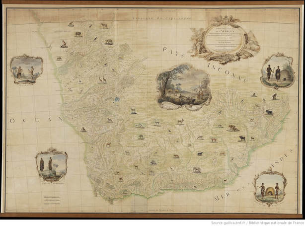 The King’s Map, a unique map of South Africa produced in 1790 for the King Louis XVI of France, on the observations of the French ornithologist and explorer Francois Levaillant, by M. de Laborde. By publishing journals about his voyages, Levaillant provided us with invaluable descriptions of South African ecosystems in the early historical period. (Public domain - Levaillant 1790). Can we afford to discard valuable ecological data when the ideal of systematic data collection is not achieved? Opportunistically collected biodiversity data contain strong sampling biases but they can also help us gain a deeper understanding of biodiversity patterns and may support, among other things, conservation initiatives. It is thus critical we develop tools to characterize and address the limitations in these data. SAMPLING BIAS IN HISTORICAL BIODIVERSITY DATASETS The collection process for biodiversity records is often spatially biased towards regions more frequented by observers. This results in observed distribution patterns that are a reflection of the intensity of sampling rather than of the actual distribution of species. As one goes back in time and starts considering historical biodiversity data collected over the last centuries, this issue of sampling bias quickly becomes the norm. Collected before any scientific protocol existed, through opportunistic and unstandardized sampling and reporting, historical biodiversity records are a statistician’s nightmare. Existing methodologies are not adapted to address sampling biases for single-species datasets that have a small sample size, which is a common feature of historical biodiversity datasets. For that reason, historical data are often perceived as untrustworthy and discarded in quantitative analyses. Because they provide unique insights into biodiversity trends over a long period of time and are key to detecting and quantifying long-term human impacts on biodiversity, we need to find ways to integrate long-term biodiversity records in modern spatial analyses. ACCESSIBILITY MAPS AS A TOOL TO PREDICT SAMPLING BIAS In our paper recently published in Ecography, we propose that accessibility maps be used as a tool to predict sampling bias in historical written occurrence records, with the aim to improve the use of these data in spatial analyses. We present a method for creating accessibility maps that does not require empirical data on the location of observers and we test how well it predicts sampling bias in a dataset of large mammal occurrence collected in the early post-colonial period (16th to 19th century) in South Africa. The historical literature – journals, diaries written by European settlers, missionaries, naturalists and explorers – contains countless pieces of information on the lifestyle and habits of early travellers. We took advantage of these to understand the factors constraining the movement of observers. Based on this information, we mapped the accessibility of the landscape as the combination of two spatial components: the proximity of European settlements and proximity to freshwater. “During the whole day we had nothing but a dry and burning desert to traverse. After dinner, two of my oxen, exhausted by thirst and fatigue, dropped down, and I was under the necessity of leaving them behind” (Le Vaillant, 1796, p.213) 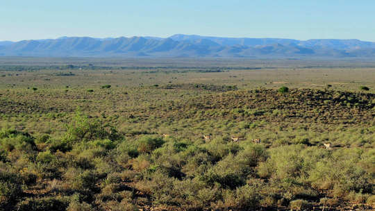 What drove the accessibility of the South African landscape for early travellers and explorers? Our (short) answer: freshwater and European settlements. View of the Karoo, a semidesert region of South Africa. Photo: S Monsarrat. RESULTS We found that accessibility maps based on simple statistical rules and only two spatial features could predict the geographical and environmental bias found in the South African dataset. These results suggest that sampling effort can be modelled accurately without the use of empirical data, given that we know the processes influencing the bias behind data collection. IMPLICATIONS FOR SPATIAL ANALYSES AND SPECIES DISTRIBUTION MODELLING We suggest that, rather than discarding historical occurrence datasets a priori due to the possible biases they may contain, accessibility maps could be used to explore sampling bias and improve the use of these data in modern quantitative analyses. More specifically, they could be used to manipulate background data in species distribution modelling to generate pseudo-absences data with a similar geographical sampling bias to that of the presence data. They could also serve to adjust model estimates by down-weighting sample points from locations with higher accessibility or to build a biased prior for the distribution of sampling effort, to be used as a bias file in the widely used species distribution modelling method MaxEnt. 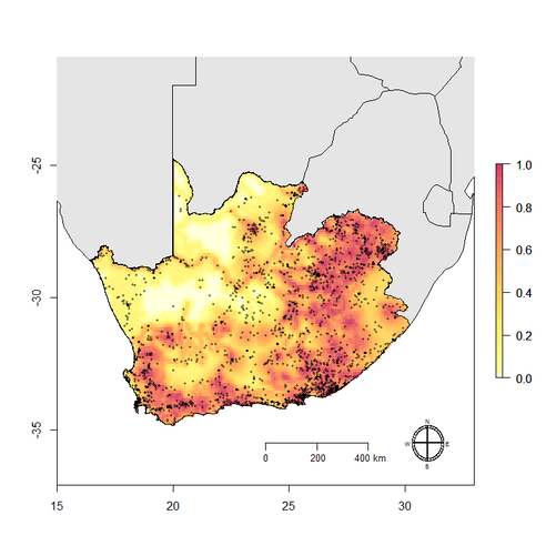 Accessibility map built from a model based on two spatial features: proximity of freshwater and proximity of European settlements. Shades of red indicate progressively higher accessibility. Black dots correspond to historical written records of large mammal occurrence for the period 1497-1920. There is a strong linear correlation between the frequency of observed occurrences and predicted accessibility index (Pearson’s correlation coefficient, ρ=0.93). FUTURE DIRECTIONS
While this study focused on historical written records of occurrence, a parallel can be made with contemporary datasets that are subject to the same type of biases. For this reason, we encourage further testing of this approach in different spatio-temporal contexts. If accessibility maps prove to be robust predictors of sampling bias in different contexts and are shown to improve the performance of species distribution models, this will provide strong support for their relevance in addressing sampling bias in the analyses of small datasets of occurrence. The code and data from our paper are available from Figshare Digital Repository (https://doi.org/10.6084/m9.figshare.c.3916342.v1). REFERENCES Levaillant, F., 1790. Partie Méridionale de l'Afrique depuis le Tropique du Capricorne jusqu'au Cap de Bonne Espérance contenant les Pays des Hottentots, des Cafres et de quelques autres Nations / dressée pour le Roi sur les observations de M. Le Vaillant par M. de Laborde, ancien premier valet de chambre du Roi, gouverneur du Louvre, l'un des Fermiers généraux de Sa Majesté. Paris: Bibliothèque nationale de France. http://catalogue.bnf.fr/ark:/12148/cb40594014v Levaillant, F., 1796. New travels into the interior parts of Africa : by the way of the Cape of Good Hope, in the years 1783, 84 and 85. London: Printed for G.G. and J. Robinson. Monsarrat, S., Boshoff, A.F., Kerley, G.I.H., 2018. Accessibility maps as a tool to predict sampling bias in historical biodiversity occurrence records. Ecography 41:1-12. doi: [10.1111/ecog.03944]. |
|
 RSS Feed
